

Set along the Ammonoosuc River in New Hampshire’s northern White Mountains, Littleton combines a vibrant historic downtown with mountain scenery, convenient regional services, and quick access to year-round outdoor recreation. Its walkable Main Street, river district, nearby trails, and proximity to Cannon Mountain, Franconia Notch, and the Connecticut River Valley make Littleton an attractive setting for primary residences, custom homes, and long-term mountain retreats.
Why People Are Building In Littleton, NH


Mosscreek, the Right Designer
Building a MossCreek designed home creates the perfect way to live in harmony with your surroundings. Every home is designed to fit carefully within its natural setting while offering the best in contemporary living. See “Custom Design” in our menu above to learn more about us and how we can help you realize a MossCreek designed home.
Finding a Builder
MossCreek has a network of builders that we regularly work with and would be glad to introduce you to them. We are also happy to work with the builder of your choice.

Build Here for Scenic Beauty and More
People are building homes in Littleton for its combination of small-town amenities, mountain access, relatively low-density residential areas, and a growing reputation as one of the North Country’s most livable communities. Current opportunities include buildable lots in established subdivisions, wooded acreage, in-town homesites, and partially completed custom residences where buyers can continue the design process. The town’s hospital, schools, shopping, dining, and highway access add everyday convenience to the White Mountains lifestyle.
Nearby Natural Gems:

Fishing
Littleton provides access to cold-water rivers, reservoirs, and mountain streams that support trout and warm-water fishing throughout the North Country.
Top-rated fishing outfitters and guides:
Popular fishing locations:

Museums and Galleries
Littleton supports an active arts and cultural scene rooted in local history, fine craft, and the creative life of the White Mountains.
Highlights include:

Hiking
Littleton offers hiking opportunities ranging from short local climbs and river walks to extensive trail systems in the nearby White Mountain National Forest.
Popular hiking trails:
- Kilburn Crags: A popular local climb above town with broad views toward the Presidential Range.
- Littleton River District Walk: A downtown river route linking footbridges, parks, and the Ammonoosuc River.
- White Mountain National Forest Trails: Extensive hiking opportunities throughout the nearby White Mountains.

Shopping
Littleton’s Main Street and River District are known for independent shops, fine craft, books, outdoor goods, specialty foods, and locally made products.
Top shopping destinations:
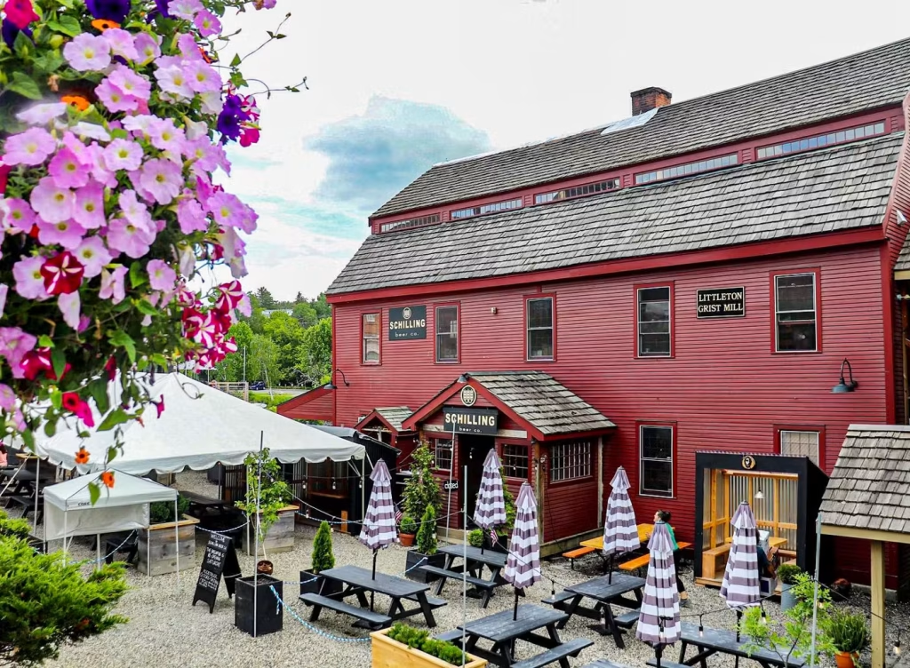
Restaurants
Littleton has one of the North Country’s strongest small-town dining scenes, with long-running diners, international cuisine, locally brewed beer, and riverside dining.
Standout restaurants:
Where People Are Building In Littleton, NH

Where People Build in the Littleton Area
Littleton’s current building market combines an active named subdivision with remaining custom homesites, established rural road and subdivision clusters with current buildable land, and newly created or proposed lots identified through municipal records. The research pass used current 2026 land and new-construction inventory, Planning Board and zoning records, subdivision fields, assessor evidence, and reverse discovery from individual listings.
Developments in and Around Littleton
New Developments
- Bear Paw Trail: An active Littleton subdivision built around large private homesites and shared recreational acreage. Multiple lots remain actively listed in 2026, including cleared or partially cleared sites ready for an individually designed home; current listings identify Bear Paw as the parent subdivision.
- Railroad Street Residential Subdivision: A four-lot residential subdivision approved by the Littleton Planning Board in 2026. Municipal records describe newly created buildable lots and a right-of-way connection toward adjoining Bethlehem land; it is retained as a recent-subdivision candidate even though no separate marketing website was found.
- North Littleton / Mount Misery Road Subdivision: A 2026 two-lot rural subdivision reviewed by the Planning Board at the corner of North Littleton Road and Mount Misery Road. It is retained under the recent-subdivision discovery rule while individual build-out proceeds outside a conventional master-development marketing program.
Growing Neighborhoods
- Osgood Farm Road: An established private-road residential cluster with current 2026 buildable acreage. Active inventory is explicitly described as subdivided land with electricity at the street and protective covenants supporting continued low-density residential build-out.
- Manns Hill / Bear Paw Area: An established hillside residential area with continuing lot adjustments, Bear Paw build-out, and current custom-home activity along Manns Hill Road. Municipal and listing evidence shows continuing residential growth rather than a single newly launched project.
- North Littleton Rural Area: The North Littleton corridor continues to generate rural subdivision and building-site activity, including the 2026 Mount Misery Road subdivision and other large-parcel residential opportunities.
Other New Construction Opportunities
- Broomstick Hill Road: Current 2026 inventory includes a 29-acre wooded parcel only a few miles from Main Street, providing substantial space for an individually planned home and potential mountain views.
- Osgood Farm Road Independent Homesites: Additional current acreage on Osgood Farm Road provides site-specific custom-home opportunities with private-road access, utilities at the street, and subdivision-era test-pit work.
- St. Johnsbury Road Building Sites: The St. Johnsbury Road corridor has continuing lot-creation activity, including a 2026 variance request intended to create an additional residential parcel from existing acreage.
- Manns Hill Road Custom Construction: Current new-construction inventory includes a partially completed custom residence on Manns Hill Road, demonstrating ongoing one-off custom building outside the remaining Bear Paw subdivision lots.
- Littleton Village and River District Infill: The established village and River District continue to provide infill and redevelopment possibilities governed through Littleton’s current subdivision, zoning, and building-permit process.
Choosing A Location
- For an active named subdivision with multiple remaining custom homesites: Consider Bear Paw Trail.
- For recently created rural residential lots: Investigate the Railroad Street and North Littleton/Mount Misery Road subdivision activity.
- For an established low-density area with current buildable acreage: Consider Osgood Farm Road or the broader Manns Hill area.
- For a larger independent custom homesite: Review Broomstick Hill Road and other rural acreage opportunities.

Where People Build in Surrounding Areas
Littleton anchors a broader North Country and White Mountains housing market. The surrounding-area pass includes bordering towns and nearby communities connected by Interstate 93, U.S. Route 302, Route 116, Route 135, and the regional custom-home market.
Communities and towns to consider include:
These communities broaden the Littleton-area search for custom subdivisions, rural acreage, village infill, and mountain-oriented building opportunities.
